
 Here are the details of the map for the Waterloo Bridge area:

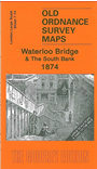
This highly detailed map at a 'Yard to the Mile' covers the area around Waterloo Bridge. The main centre of interest is along the South Bank; the Lion Brewery is shown where the Festival Hall now stands. Coverage extends eastward to Broadwall, Christ Church (on margin of map) and Brunswick Street. Features include Stamford Street, Commercial Road, St Andrews church, Clowes Printing Works. Nice coverage of an area then used for lead works, sawmills and wharves. On the north bank part of Somerset House is shown. Street directories are on the reverse, incl Belvedere Road, Commercial Road, Cornwall Road, Stamford Street, Upper Ground Street.
The map links up with sheets 7.64 Fleet Street to the north, Charing Cross to the west, 7.75 Bankside to the east and 7.84 Waterloo Station to the south.