
 Here are the details of the map for the Trafalgar Square area:

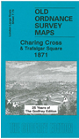
This wonderfully detailed map covers the area around Trafalgar Square, with coverage stretching from Haymarket eastward to Savoy Street. The many interesting features include Trafalgar Square, National Gallery, St George's Barracks, St Martin's Workhouse, St Martin's church, Leicester Square, Haymarket Theatre, Her Majesty's Theatre, Admiralty, Carlton House Terrace, Charing Cross Hospital, Charing Cross station, Northumberland House, Whitehall Place, much of The Strand, Adelphi, York Buildings, Adelphi Theatre, Scotland Yard. Street directory entries for Charing Cross, Cockspur Street, Haymarket, St Martins Lane, St Martin's Place, Trafalgar Square, Villiers Street.
This map, which has been out of print for several years, has been reprinted to commemorate a small reception we held at Opera Rara's production of Pacini's Alessandro nell'Indie, at the Coliseum Theatre on 19th November. Note that the map is at a slightly different scale (approx 1:1836) to others in the series.
This map links up with 7.63 Covent Garden to the north, 7.72 Piccadilly to the west, and 7.74 Waterloo Bridge to the east.