
 Here are the details of the map for the Whitechapel area:

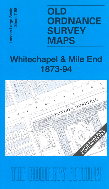
This very detailed map covers Whitechapel and part of Mile End. It is double-sided, with the 1873 map on one side and a reduced version of the 1894 map on the reverse. We also include an introduction to the history of the area.
Features (from 1871 map) include London Hospital, Whitechapel Road, part of Whitechapel workhouse, St Philip's church, Trinity Almshouses, schools, chapels, chemical works etc. The 1894 map shows the two Whitechapel stations, Albion Brewery and tramways.
The map links up with sheet 7.48 Bethnal Green East to the north, 7.57 Spitalfields to the west and 7.68 Shadwell to the south..