Old Ordnance Survey Maps of Glasgow & Lanarkshire

  • These detailed maps normally cover an area of about one and a half miles by one mile. Each map includes an introduction.
  • They are available through our On-line Mapshop

  • Here are the details of maps for Cathcart:

  • Lanarkshire Sheet 10.06 Cathcart 1910 - published 2002; intro by Gilbert Bell. ISBN.978-1-84151-361-4

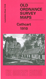
    This detailed map covers Cathcart, south of Glasgow. Coverage stretches from Merrylee Wood eastward to Carmunnock Road and Cathcart church, and from Millbrae Crescent southward to Muirend station. Features include Muirend House, Newlands, cemetery, Cathcart District Railway and station, Millholm Paper Mills, Papermill Farm, Cathcart Nurseries, Holm Foundry, Cathcart Mill, White Cart Water, ruined castle. We include a directory of Cathcart on the reverse.


    You might find this index map useful. The map links up with Sheet 10.02 Queen's Park to the north.


  • Follow this link for a complete list of our Glasgow or Lanarkshire maps.
  • You can order maps direct from our On-line Mapshop. For other information and prices, and other areas, go to The Index Page.
  • Maps in the Godfrey Edition are taken from the 25 inch to the mile map and reduced to about 15 inches to the mile. For a full list of maps for Scotland, return to the Scotland page.
    The Godfrey Edition / sales@alangodfreymaps.co.uk / 11 November 2016