 Here are the details of maps for Rutherglen (East):

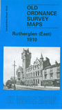
This detailed map covers the eastern half of Rutherglen. Coverage stretches from the Town Hall and Regent Street eastward to Hamilton Farm and the Clyde, and from Cowtown southward to Rosslyn Avenue. The many features include the Caledonian Railway with station, sidings, Clydebridge Junction, Rutherglen Junction and goods station; Eastfield, Eastfield Quarry, Ballochmill, Flock Factory, Clydebridge Steel Works (unnamed and closed at time of map), Easterhill Colliery, Easterhill House, Parkhead Reformatory, Gallowflat House, Clincarthill, Wardlawhill, Caledonian Pottery, Old Farme, Farme Branch, Rutherglen Rope Works. On the reverse we include a Rutherglen directory, entries M-Z.
You might find this index map useful. The map links up with Sheet 6.16 Parkhead to the north, 10.03 Rutherglen West to the west, 11.01 Carmyle to the east