Old Ordnance Survey Maps of Glasgow & Lanarkshire

  • These detailed maps normally cover an area of about one and a half miles by one mile. Each map includes an introduction.
  • They are available through our On-line Mapshop

  • Here are the details of maps for Pollok Park & Pollokshaws:

  • Lanarkshire Sheet 10.01 Pollok Park 1909 - published 2006; intro by Gilbert Bell. ISBN.978-1-84151-909-8

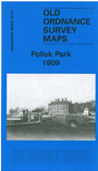
    This detailed map is centred on Pollok House, with its extensive grounds, including Deer Park and Wood. A small portion of Corkerhill is in the top left corner, while on the east is the fringe of Glasgow, with Haggs Road and Haggs Castle. A portion of Pollokshaws is in the SE corner, with Pollokshaws station, Kirk Lane Cemetery and Burgh Hall. A 1912 Directory of Pollokshaws is included on the reverse.


    You might find this index map useful. The map links up with Sheet 6.13 Bellahouston to the north, 10.02 Queen's Park to the east.


  • Follow this link for a complete list of our Glasgow or Lanarkshire maps.
  • You can order maps direct from our On-line Mapshop. For other information and prices, and other areas, go to The Index Page.
  • Maps in the Godfrey Edition are taken from the 25 inch to the mile map and reduced to about 15 inches to the mile. For a full list of maps for Scotland, return to the Scotland page.
    The Godfrey Edition / sales@alangodfreymaps.co.uk / 11 November 2016