Old Ordnance Survey Maps of Stockport MBC

  • These detailed maps normally cover an area of about one and a half miles by one mile. Each map includes an introduction.
  • They are available through our On-line Mapshop

  • Here are the details of maps for Woodley:

  • Lancashire Sheet 112.06 Woodley & Haughton Dale 1917 - published 2018; intro by Chris Makepeace. ISBN.978-1-78721-173-5

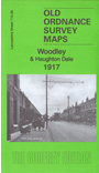
    This detailed map covers the village of Woodley, NE of Stockport, and also part of Haughton Dale.

    Features include St Mark's church, Bredbury station, Woodley Junction, sections of several railways including Cheshire Lines Railway and Great Central & Midland Joint Railway, Woodley Iron Works, Top Mill, Peak Forest Canal, tramway, Botany Mill, Haughton Dale Mills, Unity Mills, Lingard Lane Collieries, Arden Hall, Castle Hill, old colliery and clay workings, etc.

    The map links up with Lancashire Sheets 112.02 Haughton Green to the north, 112.05 South Reddish to the west.

    Part of the area is also covered in our Cheshire series by sheets 10.12 Bredbury West and 11.09 Woodley.


  • Follow this link for a complete list of our Stockport or Manchester maps.
  • You can order maps direct from our On-line Mapshop. For other information and prices, and other areas, go to The Index Page.
  • Maps in the Godfrey Edition are taken from the 25 inch to the mile map and reduced to about 15 inches to the mile. For a full list of maps for the North West, return to the North West page.
    The Godfrey Edition / sales@alangodfreymaps.co.uk / 1 September 2018