
 Here are the details of maps for Waterloo:

We have published two versions of this detailed map, showing how the area changed across the years.
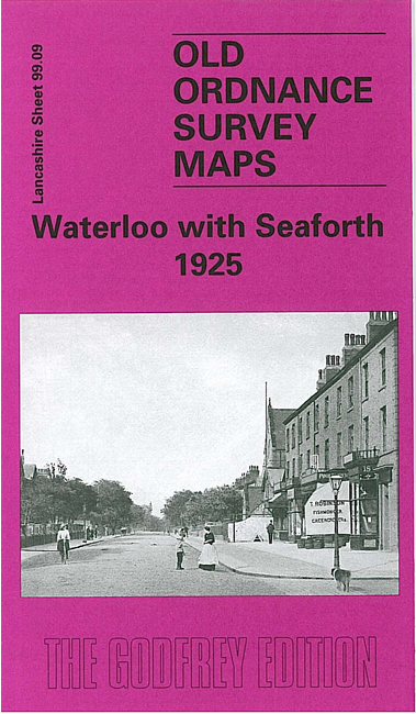
The maps cover Waterloo, a few miles north of Liverpool, plus the northern part of Seaforth and western part of Litherland. Coverage stretches from Milton Road southward to Clarement Road, and from the coast inland to Litherland Park. Features include Waterloo Park, Seaforth Barracks, Lewlithia Park, railway with station, Christ Church, Marine Terrace Green, tramways, Leeds & Liverpool Canal, Litherland Tannery, Sefton Tannery, sugar refinery, Diamond Laundry, etc. On the reverse we include sheet 98.12 which extends coverage eastward to include the Oxford Drive area.
This map links up with sheet 98.08 Blundellsands to the west, 99.05 Great Crosby to the north and 99.13 Bootle Docks to the south, 99.10 Litherland East to the east,