
 Here are the details of maps for Gathurst:

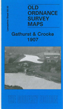
This detailed map covers the Gathurst and Crooke area, west of Wigan; coverage stretches from Crooke westward to Dean Cottages, and from John Pit Colliery southward to Ackhurst Hall.
Features include LYR Wigan-Southport line with Gathurst station, Branckers Siding, mineral railway to canal, Leeds & Liverpool Canal, River Douglas, Crooke village, Crooke Hall, Otters Croft Wood, remains of Tunnel Canal, John Pit colliery with mineral railway, John Pit Houses, Gathurst Mount, Roburite Explosives Works and tramways, Ackhurst Hall, Gathurst Fold, Milk House Cottage, Dean Locks, Gathurst Farm,
This map links up with Sheets 93.03 Wigan NW to the east and 93.06 Orrell Post to the south.