
 Here are the details of maps for Rochdale South:

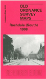
This detailed map covers the southern part of Rochdale, with coverage extending from Rochdale station southward to Balderstone Hall and Buersill, and from Boundary Street eastward to Moss Side Lane. Features include Rochdale station, part of railway works, Lower Lane Iron Works, Rochdale Canal, tramways, Lower Place, Stoneyfield, part of Castleton Wards South and East, and many mills. These include Eagle Mill, Green Mill, Dicken Green Mill, Norwich Street Mills, Grove Mills, Era Mill, Victoria Mill, Moss Mill, State Mill and others. We include extracts from a street directory on the reverse, incl Hare Street, King Street East, Oldham Road, Royds Street.
The map links up with Lancashire Sheets 89.01 Rochdale to the north, 88.08 Rochdale SW to the west, 89.05 Milnrow to the east.