
 Here are the details of maps for Bury South:

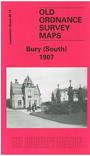
This detailed map covers the southern part of Bury, with coverage extending from Gigg Lane southward to Hollins, and from Redvales Farm eastward to Hollins Vale. Features include the football ground, Cemetery, Hampson Mills, Nuttall Square, Barlow Fold, New Bridge Mills, Irwell Bleach Works, Redvales, St Peter's church, Goshen Farm, River Roch, Gigg with paper mills, Hollins Vale with bleach works, Fletcher Fold, Hollins Brook, tramways. This was still a semi rural area with a few scattered industrial hamlets. On the reverse we include various directory extracts.
The map links up with Lancashire Sheets 88.09 Bury to the north, 87.16 Radcliffe North to the west, 96.01 Unsworth to the south.