Old Ordnance Survey Maps of Wigan MBC

  • These detailed maps normally cover an area of about one and a half miles by one mile. Each map includes an introduction.
  • They are available through our On-line Mapshop

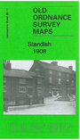
  • Here are the details of maps for Standish:

  • Lancashire Sheet 85.11 Standish 1908 - published 2011; intro by Alan Godfrey. ISBN.978-1-84784-485-9

    This highly detailed map covers the northern part of Standish.

    Features include village centre, St Wilfrid's church, Standish Brewery, St Marie's RC church, The Grove, Rectory, Langtree Grange, LNWR railway with Standish station, Bradley Mills, Bradley Hall, Broomfield Pit, Langtree Pit No.12, Mineral Railways, Langtree Hall, Standish Bleach Works, railway junctions, etc. We include a 1918 directory of Standish on the reverse.

    The map links up with sheet 85.12 Red Rock to the east, 85.15 Standish (Boar's Head) to the south.


  • Follow this link for a complete list of our Wigan or Bolton maps.
  • You can order maps direct from our On-line Mapshop. For other information and prices, and other areas, go to The Index Page.
  • Maps in the Godfrey Edition are taken from the 25 inch to the mile map and reduced to about 15 inches to the mile. For a full list of maps for the North West, return to the North West page.
    The Godfrey Edition / sales@alangodfreymaps.co.uk / 4 March 2018