
 Here are the details of maps for Preston:

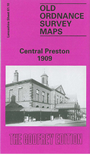
This detailed map covers the central area of Preston, with coverage stretching from Adelphi Street eastward to Acregate Lane, and from St Thomas's Road southward to Syke Street. Most of the town centre is shown, and features include Fishergate, Church Street, tramways and depot, Yard Works, Royal Infirmary, Deepdale Enclosure, St Peter's church, Town Hall, St John's church, New Preston Mills, Alliance Works, Fishwick Mills, India Mill, Peel Mill, Deepdale Mill, Alexandra Mill, Victoria Mills, Deepdale Siding, Park Mills, Bute Mill, Marathon Skating Rink, Market Place, Sovereign Mill, St Paul's church, Green Bank Mills, St Ignatius's RC church, Cliff Mill, Ribbleton Mill, Albert Mill, Wharton Mill etc. Note that the station is just off the map to the south. We include selections from a street directory on the reverse, incl Back Lane, Corporation Street, Deepdale Road, Lune Street, Tithebarn Street.
The map links up with Sheet 61.09 Preston (West) to the west.