
 Here are the details of maps for Grange over Sands:

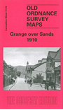
This detailed map of Grange is double-sided for maximum coverage. The main map covers the northern part of this small resort, with coverage extending from The Esplanade and Rockland Road northward to Eggerslack Wood, and from the Grange cemetery eastward to Paradise Hill. Features include Yewbarrow Hall, High Farm, Grange Fell, St Charles RC church, Crown Hotel, railway station, Grange Hotel, Blawith, Hazelwood Hydropathic (but cut by margin), and many villas. On the reverse we include adjacent sheet 17.08 extending coverage southward to part of Kents Bank. Features include pier, Cart Lane, Cat Tree Bank, Graythwaite Manor, Seawood, and more villas, many of them named.