
Old Ordnance Survey Maps of Christchurch
These detailed maps normally cover an area of about one and a half miles by one mile. Each map includes an introduction.
They are available through our On-line Mapshop
 Here are the details of maps for Christchurch:
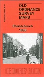
Hampshire Sheet 86.12 Christchurch 1896 - published 1997; introduction by Alan Godfrey. ISBN 978-0-85054-885-3 
This detailed map covers the centre of Christchurch and the area to the south and east. Within the town the High Street, Castle Street, Bridge Street and
the magnificent church are covered but please note the map does not extend north to the station. The map extends east to Purwell Cross, and across Stanpit Marsh to
Stanpit and Blackberry Point. Although the sheetlines are not very kind, the many inlets, including Mother Siller's Channel, make this an attractive map
and remind us that Christchurch first became important as a port. On the reverse we include a directory of the town in 1895.
Follow this link for a complete list for Bournemouth Christchurch & Poole maps, or follow these links for
the rest of Dorset, or Hampshire, or for the whole South West region.
For other information and prices, and other areas, go to The Index Page.
Maps in the Godfrey Edition are taken from the 25 inch to the mile map and reduced to about 15 inches to the mile.
For a full list of maps for England, return to the England page.
Alan Godfrey Maps, Prospect Business Park, Leadgate, Consett, Co Durham, DH8 7PW / sales@alangodfreymaps.co.uk / 8 June 2026
 Here are the details of maps for Christchurch: