 Here are the details of maps for Hilsea:

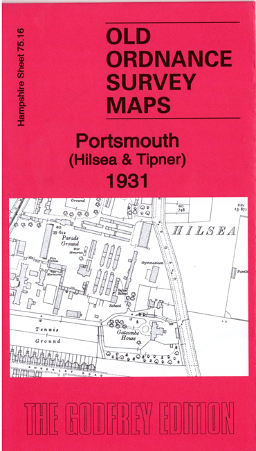
This detailed map covers the northern part of Portsmouth, with Hilsea covering the eastern half of the map, and coverage extending westward to Tipner and Horsea Island.
Features include Hilsea village, barracks, Gatcombe House, Parade Ground, Garrison Church, Hilsea House, Hilsea Farm, Ports Bridge, tramway, Hilsea College, West Bastion, West Demi-Bastion, West Centre Curtain, North End Recreation Ground, Hospital, Alexandra Club, Tipner Point, Tipner House, Horsea Island. The map shows The Lines, which had been made surplus to requirement in the 1920s, and other military establishments, all of them explained by Tony Painter, a regular contributor to this series and for many years a Ministry of Defence Map Research Officer.
The map links up with Hampshire Sheets 75.12 Cosham to the north, 83.04 Portsmouth North End to the south.
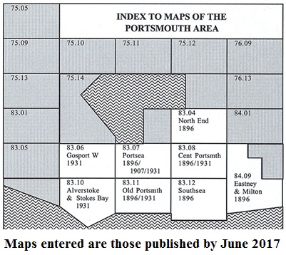
You might find this Index Map useful.