Old Ordnance Survey Maps of Hampshire

  • These detailed maps normally cover an area of about one and a half miles by one mile. Each map includes an introduction.
  • They are available through our On-line Mapshop

  • Here are the details of maps for Romsey

  • Sheet 56.04 Romsey 1908 - published 2018; intro by Pamela Taylor. ISBN.978-1-78721-119-3

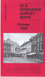
    This map covers most of the Hampshire town of Romsey and all the town centre is covered in detail.

    Features include railway with station and Romsey Junction, Abbey Church, Abbey Mills, Test Mill, Saddler's Mill, Market Place, Pig Market, brewery, St Joseph's RC Orphanage, nurseries, mill races, Middle Bridge, Burnt Mill, Test Valley Iron Works, Harrage Park area, motor works, Romsey Union Workhouse, Durban House, Romsey Cemetery, Whitenap, Harefield etc.We include extracts from an 1899 directory on the reverse.


  • Follow this link for a complete list for Hampshire.
  • You can order maps direct from our On-line Mapshop. For other information and prices, and other areas, go to The Index Page.
  • Maps in the Godfrey Edition are taken from the 25 inch to the mile map and reduced to about 15 inches to the mile. For a full list of maps for England, return to the England page.
    Alan Godfrey Maps, Prospect Business Park, Leadgate, Consett, Co Durham, DH8 7PW / sales@alangodfreymaps.co.uk / 31 January 2018