
 Here are the details of maps for central Gloucester :

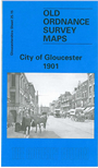
This detailed map covers the central area of Gloucester, with coverage extending NE towardes Oxstalls and Cole Bridge. Features include the Cathedral, Westgate Street, Eastgate Street, Soutgate Street, Northgate Street, tramways, Shire Hall, St Catharine's church, Infirmary, Market, GWR and MR stations, locomotive sheds, Wotton Vill, First County Lunatic Asylum, Hillfield House, Barnwood Bridge, Wotton Farm, cattle market, Kingsholm, football ground, vinegar works, Workhouse, and much more. On the reverse we include contemporary street directory entries for Eastgate Street, Northgate Street, Southgate Street, Westgate Street.
The map links up with Gloucs sheet 25.14 Gloucester NW to the west and 33.03 Gloucester SE to the south.
Maps in the Godfrey Edition are taken from the 25 inch to the mile map and reduced to about 15 inches to the mile. For a full list of maps for England, return to the England page.
Alan Godfrey Maps, Prospect Business Park, Leadgate, Consett, Co Durham, DH8 7PW / sales@alangodfreymaps.co.uk / 28 October 2016