 Here are the details of maps for Gloucester NW:

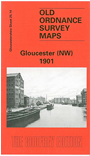
This detailed map covers the NW area of Gloucester, including the Docks.The River Severn runs through the map, with the East Channel curving round towards the city. The map includes the prison (left blank as usual for security reasons), The Docks, Victoria Dock (in SE corner of map), Barge Arm, cranes etc, Llanthony Dock, barracks, Lower Westgate Street, Over Causeway, Archdeacon Meadow, The Island, Castle Meads, Sud Meadow, Oxlease, Port Ham, Town Ham, GWR Docks Branch, stretch of main GWR line with Over Junction, Over Bridge, part of Over incl Dog Inn, Over Farm. On the reverse we include extracts from an 1894 directory, including private residents A-Ha.
The map links up with Gloucs sheet 25.15 City of Gloucester to the east and 33.02 Gloucester SW to the south.
Maps in the Godfrey Edition are taken from the 25 inch to the mile map and reduced to about 15 inches to the mile. For a full list of maps for England, return to the England page.
Alan Godfrey Maps, Prospect Business Park, Leadgate, Consett, Co Durham, DH8 7PW / sales@alangodfreymaps.co.uk / 28 October 2016