
 Here are the details of our map for Fountainbridge and Dalry:

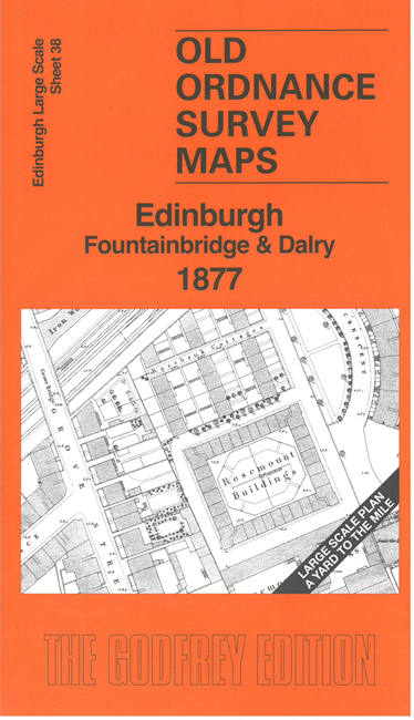
This highly detailed map covers the around Fountainbridge, with coverage from Dalry Road eastward to Gillespie Crescent and Earl Grey Street. Features include railways with Dalry Junction, Union Canal, Lochrin Basin, Rosemount Buildings, Fountain Brewery, St Peter's Free Church, Gillespie's Hospital, Edinburgh Slaughterhouses, chapels and churches, etc.
On the reverse we include 1:500 sheet III.11.2 covering the Dalry House and Fountain Brewery at a later date.
The map links up sheet 34 Western New Town to the north and 39 Lauriston to the east.