
 Here are the details of maps for Witton Gilbert:

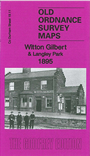
This detailed map is double-sided for maximum coverage. The main map has the village of Witton Gilbert in the NE corner, the centre of Langley Park in the south west corner; it extends south as far as Quebec Street and Cooperative Terrace. Features include Langley Park Hotel, Wall Nook, Stobbilee, Bleach Green, Witton Gilbert station, Kaysburn Pumping Station, Kaysburn brickworks, St John's Green, Witton Hall, St Michael's church, Glendinning Arms, Travellers Rest pub etc. On the reverse we include part of adjacent sheet 19.10 extending coverage westward to include Langley Park Colliery, coke ovens, waggonway to pit and drift, Park House, All Saints church, Quebec Street
The map links up with part of sheet 19.08 Sacriston to the north.