
 Here are the details of maps for Sacriston:

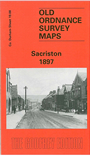
This very detailed map covers the colliery village of Sacriston, a few miles north of Durham. The map is double-sided to give maximnum coverage. The main map covers an area from the village centre and Front Street eastward to Nettlesworth and Kimblesworth. Features include Sacriston Colliery (in top left corner), St Peter's church, Sacriston Colliery Inn, Findonhill Quarry, Barrashill Wood, Hobbletrot Quarry. The backing map, a large extract from sheet 19.07, takes coverage further west and includes the colliery coke ovens, Charlaw Colliery, wagonway, Fulforth Wood, Laverick Hall. A directory of Sacriston in 1890 is also included, showing that this was a large village, with a population in 1881 of 4,180, "principally colliers".
The map links up with Sheet 19.03 Holmside & Edmondsley to the north and part of sheet 19.11 Witton Gilbert to the south.