 Here are the details of maps for Rowlands Gill:

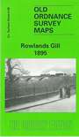
This very detailed map covers the village of Rowlands Gill, today at the southern end of Gateshead Borough. In 1895 this was scarcely a village and there was little here other than a row of houses, a station on the NER Consett Branch, and the Towneley Arms. To the north is the Lily Drift mine. The River Derwent meanders through the map and to the east is Gibside with its grounds and mausoleum chapel, by James Paine. The map stretches east to Gibside Hill Head. On the reverse we include part of sheet 5.12, extending coverage west to Victoria Garesfield and its colliery , with the Victoria Garesfield Colliery Railway.
The map links up with Sheet 6.13 Burnopfield to the south.
Maps in the Godfrey Edition are taken from the 25 inch to the mile map and reduced to about 15 inches to the mile. For a full list of maps for England, return to the England page.
Alan Godfrey Maps, Prospect Business Park, Leadgate, Consett, Co Durham, DH8 7PW / sales@alangodfreymaps.co.uk / 14 January 2018