 Here are the details of maps for Blackhall Mill:

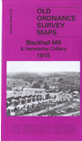
This very detailed map covers Blackhall Mill and Hamsterley Village.
Features include Hamsterley village, Hamsterly Colliery with section of NER Consett Branch, High Westwood station (partly shown), Blackhall Mill, Derwent Cote House, Pickle Bank Wood, Derwent Cote Forge, steel furnace (disused), Armonside, Carr House, part of Chopwell Woods, Hagg House etc.
The map links up with Sheet 5.11 Chopwell to the north.
Maps in the Godfrey Edition are taken from the 25 inch to the mile map and reduced to about 15 inches to the mile. For a full list of maps for England, return to the England page.
Alan Godfrey Maps, Prospect Business Park, Leadgate, Consett, Co Durham, DH8 7PW / sales@alangodfreymaps.co.uk / 8 December 2018