Old Ordnance Survey Maps of Dumfries & Galloway
This page summarises the local government organisation of Dumfries & Galloway since 1890.
 Dumfriesshire, Kirkcudbrightshire and Wigtownshire were three of Scotland's historic counties in 1890.
They remained independent until 1975 when they were merged into the new Dumfries & Galloway Region. This is now a unitary council.
Dumfriesshire, Kirkcudbrightshire and Wigtownshire were three of Scotland's historic counties in 1890.
They remained independent until 1975 when they were merged into the new Dumfries & Galloway Region. This is now a unitary council.
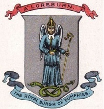
In 1890 Dumfriesshire had the following burghs: Annan (royal burgh), Dumfries (royal burgh), Lochmaben (royal burgh), Sanquhar (royal burgh), Langholm, Lockerbie, Moffat.
Kirkcudbrightshire had the following burghs: Kirkcudbright (royal burgh), New Galloway (royal burgh), Castle Douglas, Dalbeattie, Gatehouse of Fleet, Maxwelltown.
Wigtownshire had the following burghs: Stranraer (royal burgh), Whithorn (royal burgh), Wigtown (royal burgh), Castle Douglas.
In 1931 Maxwelltown was absorbed by Dumfries.
In 1975 there was major reorganisation as the counties were abolished and replaced by 12 Regions. Dumfriesshire, Kirkcudbrightshire and Wigtownshire were merged into the new Dumfries
& Galloway Region.
Beneath the region in a two-tier structure were 4 Districts: Annandale & Eskdale, Nithsdale, Stewartry (which included much of the former Kirkcudbrightshire), and Wigtown.
In 1996 there was further reorganisation as the Regions and Districts were abolished and replaced by 32 unitary councils. Dumfries & Galloway then became
a unitary authority.
For a list of Dumfries & Galloway maps go to the Dumfries & Galloway page.
For a full list of Scottish maps, return to the Scotland page
You can order maps direct from our On-line Mapshop.
Minor changes are not listed here, but please advise us of any significant errors or omissions.
Alan Godfrey Maps, Prospect Business Park, Leadgate, Consett, DH8 7PW. Tel 01207 583388
The Godfrey Edition / sales@alangodfreymaps.co.uk / 18 November 2016