Old Ordnance Survey Maps of Dunbartonshire
These detailed maps normally cover an area of about one and a half miles by one mile. Each map includes an introduction.
They are available through our On-line Mapshop
 Here are the details of maps for Helensburgh:
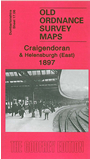
Dumbartonshire Sheet 17.06 Craigendoran & Helensburgh (East) 1897 - published 2006; intro by Gilbert Bell. ISBN.978-1-84151-899-2 
This detailed map covers the eastern part of Helensburgh, with coverage stretching from Charlotte Street eastward to Black Wood and Camis Eskan, and from
Albert Street and Millig Street East southward to Craigendoran station and pier. Several of the streets of the town are shown here, including Montrose St East,
King St East, Clyde St East and the area around Eastend Public Park and Granville Street. On the reverse we include sheet 17.10 taking coverage
southward a mile along the coast
Follow this link for a complete list of our Dunbartonshire maps.
You can order maps direct from our On-line Mapshop.
For other information and prices, and other areas, go to The Index Page.
Maps in the Godfrey Edition are taken from the 25 inch to the mile map and reduced to about 15 inches to the mile.
For a full list of maps for Scotland, return to the Scotland page.
The Godfrey Edition / sales@alangodfreymaps.co.uk / 11 November 2016