 Here are the details of maps for Gwersyllt & Moss :

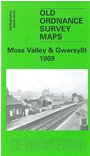
This detailed map covers a busy area north of Wrexham, with several railways and communities shown. Coverage stretches from Pentre eastward to Fishpond Wood, and from Summer Hill southward to Stansty Farm. Communities and areas shown include Cerni, Pentre, Pentre-isaf, Bryn-teg, Pool Mouth, Little Mountain, Summer Hill, Wheatsheaf, Glan-llyn. The Moss Valley runs up the western side of the map. Railways include stretches of the GWR Moss Valley Branch with Moss Halt, GWR Ffrwd Branch, GCR Westminster Colliery Branch, GWR Wheatsheaf Branch (part shown disused), GCR Brymbo Branch, and GCR line with Gwersyllt station. Other features include Gwersyllt Colliery, Holy Trinity church, The Wauns, Gwersyllt Hill, Westminster Colliery, St Paul's church, Moss Quarry, other quarries, etc. On the reverse we include directories of Gwersyllt and Broughton.
The map links up with Sheets 28.02 Brymbo to the west and 28.07 New Broughton to the south.