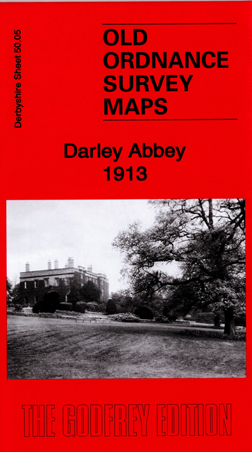
Derbyshire 50.05 Darley Abbey 1913 - published 2020; intro by Barrie Trinder. ISBN.978-1-78721-325-8 
This map covers the village of Darley Abbey, on the north side of Derby.
Features include Darley Abbey, paper mill, Boar's Head Cotton Factory, Darley House, St Matthew's church, River Derwent, Midland Railway,
Great Northern Railway, fever hospital etc.
On the reverse of the map we include directories for Darley Abbey in 1891 and 1895 plus a specially written introduction to the history of the area.
The map links up with Derbyshire sheets 50.09 Derby North to the south.
Follow this link for a list of our maps for Derby and here for the rest of Derbyshire.
You can order maps direct from our On-line Mapshop.
For other information and prices, and other areas, go to The Index Page.
Maps in the Godfrey Edition are taken from the 25 inch to the mile map and reduced to about 15 inches to the mile.
For a full list of maps for England, return to the England page.
Alan Godfrey Maps, Prospect Business Park, Leadgate, Consett, Co Durham, DH8 7PW / sales@alangodfreymaps.co.uk / 10 June 2020
 Here are the details of maps for Darley Abbey: