Old Ordnance Survey Maps of Derbyshire

  • These detailed maps normally cover an area of about one and a half miles by one mile. Each map includes an introduction.
  • They are available through our On-line Mapshop

  • Here are the details of maps for Staveley:

  • Derbyshire 18.12 Staveley (North) 1914 - published 2020; intro by Barrie Trinder. ISBN.978-1-78721-297-8
  • Derbyshire 18.16 Staveley (South) 1914 - published 2020; intro by Barrie Trinder. ISBN.978-1-78721-298-5

    These two maps link up with each other to provide excellent, detailed coverage of Staveley.

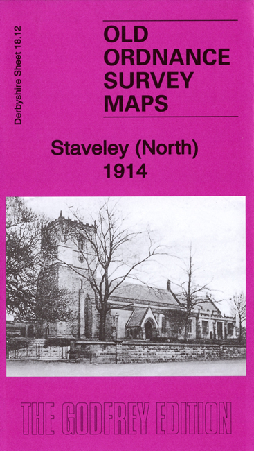
    Sheet 18.12 covers the north of the town, including Staveley Town station, section of Great Central Railway, Midland Railway Staveley Line, Barrow Hill & Staveley Works station, mineral railway, St John's church, Hartington Colliery, MR North Midland Branch, Devonshire Works, etc.

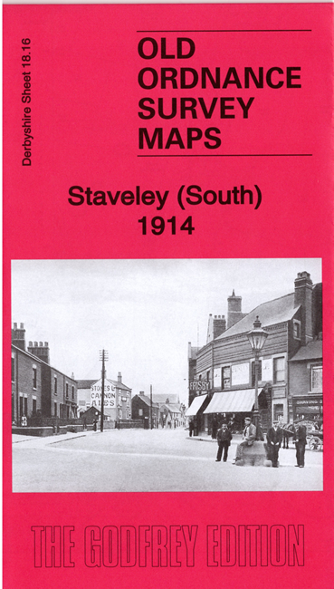
    Sheet 18.16 covers the south of the town, with features including town centre, Ireland Colliery, Great Central Railway, incl Chesterfield Loop, engine shed, Block Cottage, Staveley Works station, Troughbrook Lodge, Chesterfield Canal, etc.

    Each map includes a specially written introduction by Barrie Trinder, together with extracts from contemporary directories.

    Sheet 18.16 links up with 18.15 Brimington to the west.


  • Follow this link for a list of our maps for Derbyshire.
  • You can order maps direct from our On-line Mapshop. For other information and prices, and other areas, go to The Index Page.
  • Maps in the Godfrey Edition are taken from the 25 inch to the mile map and reduced to about 15 inches to the mile. For a full list of maps for England, return to the England page.
    Alan Godfrey Maps, Prospect Business Park, Leadgate, Consett, Co Durham, DH8 7PW / sales@alangodfreymaps.co.uk / 20 January 2020