 Here are the details of maps for Northwich NE:

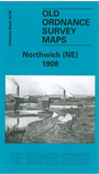
This detailed map covers the NE part of Northwich, plus parts of Lostock Gralam and Wincham. Coverage stretches from Brook Street (Northwich) eastward to Wincham Hall and northward to Chapel Street (Wincham). Features include St Helen's church, Northwich; Cheshire Lines Railway with Northwich station, engine shed, mineral railways, sidings; Witton Sewage Farm, Ashton's Salt Works, Ashton's Flashes, Neumann's Flashes, Manor Croft, Nelson Pumping Station, Lostock Salt Works, Trent & Mersey Canal, Lostock Bleach Works, Lostock Alkali Works, Wincham Mills, Winchambrook Pumping Station, Victoria Salt Works, Wincham Hall, Wincham Brook etc. On the reverse we include the Northwich Commercial directory, entries M-Y, plus a railway timetable for the Crewe-Northwich-Greenbank line.
The map links up with Cheshire sheet 34.05 Northwich NW to the west.