 Here are the details of maps for Winnington:

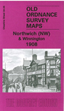
This detailed map covers Winnington and the NW part of Northwich. Small portions of Barnton and Anderton are also included in the top left corner. Coverage stretches from Nursery Road (Barnton) eastward to Witton Flashes, and southward to Verdin Park. The Winnington Alkali Works is a major feature on the map. Other features include River Weaver, Anderton Basin, Anderton Salt Works, British Company's Salt Works, Eureka Salt Works, Worboise Works, Trent & Mersey Canal, Northwich & Winnington Sewage Works, Winnington Hall, Winnington Park, football ground, St Luke's church, Verdin Park, Cheshire Lines Railway branch, infirmary, Witton Salt Works, Barons Quay, Bull Ring, Dane Bridge, Yorkshire Buildings, Market Hall, Swine Market treet, Baronsquay Rocksalt Mine, Witton Street etc. On the reverse we include a section of the Northwich commercial directory, entries A-L.
The map links up with Cheshire sheet 34.06 Northwich NE to the east and 34.09 Northwich SW to the south.