Old Cadastral Maps of Belgium
Our one map for Belgium is taken from the Cadastral Atlas of Belgium published by P C Popp (1805-79).
Originally published at a scale of 1:1250 and reduced by us to 1:2340 (27" to the mile) it includes much of the detail familiar
to users of our Old Ordnance Survey Maps.
Historical notes are in French and English.
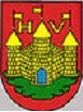
- Province de Liège: Huy 1865 - introduction by Alan Godfrey. ISBN.978-0-85054-899-0

You can order maps direct from our On-line Mapshop.
Alan Godfrey Maps, Prospect Business Park, Leadgate, Consett, DH8 7PW. Tel 01207 583388
The Godfrey Edition / sales@alangodfreymaps.co.uk / 13 Novembver 2016