Old Ordnance Survey Maps of Ayrshire

  • These detailed maps normally cover an area of about one and a half miles by one mile. Each map includes an introduction.
  • They are available through our On-line Mapshop

  • Here are the details of maps for Largs:

  • Ayrshire Sheet 3.12 Largs 1895 - published 2008; intro by Gilbert Bell. ISBN.978-1-84784-111-7

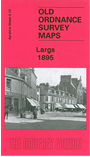
    This detailed map covers the Ayrshire coastal town of Largs. Coverage stretches from Brisbane Street southward to John Street, and from the shore eastward to Swinsholm and Castle Hill. Features include railway with station, harbour, Largs Castle, Curling Hall, Flatt, Halkshill, Gogoside, Gogo Mill, Hyndman's Green, churches, Main Street, Gallowgate Square, Bath Hall, and all individual houses etc. We include extracts from an early trade directory.


  • Follow this link for a complete list of our Ayrshire maps.
  • You can order maps direct from our On-line Mapshop. For other information and prices, and other areas, go to The Index Page.
  • Maps in the Godfrey Edition are taken from the 25 inch to the mile map and reduced to about 15 inches to the mile. For a full list of maps for Scotland, return to the Scotland page.
    The Godfrey Edition / sales@alangodfreymaps.co.uk / 15 November 2016