We have very good coverage for Kirklees Metropolitan Borough, which was formed in 1974 from the Dewsbury and Huddersfield County Boroughs, Batley and Spenborough Municipal Boroughs, and Colne Valley, Denby Dale, Heckmondwike, Holmfirth, Kirkburton, Meltham and Mirfield Urban Districts.
The following titles are all taken from the OS 25" maps and reduced to a scale of approximately 14 inches to the mile. Each covers an area of a mile and a half by one mile, and includes an introduction. Click on the links below for further details. All maps are available from our On-line Mapshop.
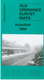 Here are the details of maps for Holmfirth:

This detailed map covers Holmfirth, famous today as the setting for much of 'The Last of the Summer Wine'. At the start of the 20th century it was also notable for the postcards being produced by a local artist and photographer, James Bamforth; he also produced short, silent films with local people as actors. Our map covers most of the village and features include Holy Trinity church, railway station, Cinder Hills, Under Bank, Swan Bank Mill, Gully, New Gate, New Fold, Cliff, Lane End, New Town, Bridge Fold, Ribbleden Mills, Bridge Mills, Victoria Square, Hill, Victoria Iron Works, Dyson's Mill, Prickleden Mill, Lower Mills, Spring Lane Mills, Riverside Mills, St John's church. In the top right corner is part of the village of Wooldale, incl Wooldale Hall, Kirkroyds. A directory of Holmfirth is included on the reverse. With indiviudal houses neatly delineated this is a splendidly detailed portrait of a much loved village - even for those who have never visited in person.