Old Ordnance Survey Maps of Wakefield


We have published more than 2,000 maps in our series of Old Ordnance Survey Map reprints, including a group for the Yorkshire area. The maps are highly detailed. They are taken from the OS 1:2,500 (or 25 inch) maps and reduced to about 15 inches to the mile. Each covers an area of a mile and a half by a mile. They show streets with individual houses, tram tracks, railway tracks and even signals, factories, wharves and such details as fountains and water troughs. They will provide hours of fascination for historians and genealogists. The maps are neatly folded and each includes a specially written introduction to the area. Maps can be purchased on our On-line Mapshop where further information about titles is given. Or visit The Index Page for a full list to the series and details of Prices.


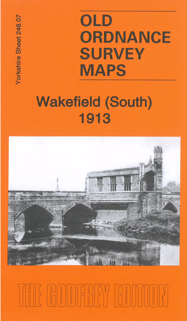
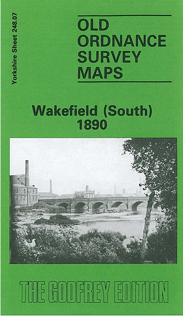
Here are the details of maps for Wakefield (S) & Thornes:

  • Yorkshire Sheet 248.07 Wakefield (South) 1890 - published 1987; introduction by John Goodchild

    This detailed map is taken from the 1st Edition Ordnance Survey plan for the area. It covers the southern part of Wakefield, with coverage stretching from George Street southward to Sparable Lane. Several railways cross the map, which includes Kirkgate station and engine shed. This is a busy map and the many features include the River Calder with piers, Aire & Calder Navigation, Calder Mills, Providence Terrace, malthouses, Rutland Mills, Old Bridge Brewery, Fall Ings, Calder Vale, Grove Iron Works, New Wells, Primrose Hill, chemical works, Belle Vue, St Catherine's church, Wakefield Trinity football ground, Cametery, cattle market, part of Westgate, Eagle Brewery. Part of Thornes village is in the SW quarter, including St James church, Bishop Blaize Inn, Lowe Hill. An extensive selection of street directory entries is on the reverse, incl George Street, Ings Road, Kirkgate, Southgate, Thornes Road.

    The map links up with Sheet 248.03 Wakefield North to the north.


    Follow this link for a complete list of our Wakefield maps; or here for the whole Yorkshire series.

    You can order maps direct from our On-line Mapshop. For other information and prices, and other areas, go to The Index Page.


    Maps in the Godfrey Edition are taken from the 25 inch to the mile map and reduced to about 15 inches to the mile. For a full list of maps for England, return to the England page.

    Alan Godfrey Maps, Prospect Business Park, Leadgate, Consett, Co Durham, DH8 7PW / godfreyedition@btinternet.com / 31 July 2007