
 Here are the details of maps for Alverthorpe:

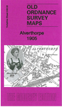
This detailed map covers the village of Alverthorpe, just NW of Wakefield. It also includes the hamlet of Flanshaw.
Features include village centre with all buildings neatly shown, St Paul's church, Silcoates Hall, Bective Mills, Flanshaw, Flanshaw Mill, railway with Alverthorpe station, New Scarborough, Alverthorpe Mills, Victoria Flock Mill etc. We include an 1889 directory of Alverthorpe on the reverse.
The map links up with sheets 248.01 Ossett N to the west, 248.03 Wakefield N to the east, 248.06 Wakefield West to the south.