We have very good coverage for Kirklees Metropolitan Borough, which was formed in 1974 from the Dewsbury and Huddersfield County Boroughs, Batley and Spenborough Municipal Boroughs, and Colne Valley, Denby Dale, Heckmondwike, Holmfirth, Kirkburton, Meltham and Mirfield Urban Districts.
The following titles are all taken from the OS 25" maps and reduced to a scale of approximately 14 inches to the mile. Each covers an area of a mile and a half by one mile, and includes an introduction. Click on the links below for further details. All maps are available from our On-line Mapshop.
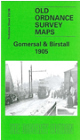 Here are the details of maps for Gomersal:

This detailed map covers the Yorkshire villages of Gomersal and Birstall. Features at Gomersal include Gomersal Hall, LNWR station, Birdacre, Grove Chapel, Gomersal Mill, Upper Spen Mills, Gomersal Hill Top, St Mary's church, Gomersal Chemical Works, Upper Lane Mills. On the eastern side of the map is the village of Birstall, where features include Oakwell Soap Works, Market Place, St Peter's church, Rectory Farm, College Mill, Carrs Mill, Brier Mill, Ridings Hall, Birstall Smithies, Birstall Foundry, Brier Hall, Popeley House, Popeley Mills, tramway. Part of the LNWR Birstall Branch terminus is at the eastern margin. We include 1889 directories for both villages on the reverse.
The map links up with sheet 232.02 Birkenshaw to the north, 232.05 Cleckheaton to the west, 232.07 Upper Batley to the east 232.10 Liversedge to the south.