
 Here are details of maps for Salisbury:
We have published three maps for Salisbury. These link up with each other to provide excellent coverage of the city.

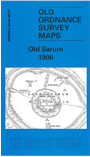
Sheet 66.07 covers the historic Old Sarum, the Roman Sorbiodunum, incl site of old cathedral. To the west is the village of Stratford sub Castle, including St Lawrence's church, Manor House, Parsonage Farm, site of Parliament Tree. To the east is Castle Hill, with Old Sarum Farm. On the reverse we include an extract from the First Edition six-inch map of 1887-9, showing the area at an earlier stage.
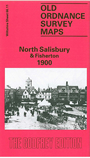
Sheet 66.11 covers the northern part of Salisbury, with coverage extending from the Market Place northward to Victoria Park, and from Bemerton Lodge eastward to Weeping Cross. Features include railway with station, GWR terminus, tunnel, Fisherton Junction, Market Branch, engine sheds; St Paul's church, St Thomas church, St Mark's church, St Edmund's church, Cheese Market, Fisherton Anger Without, Fisherton Anger Within, St Edmund parish, Elm Grove, Fisherton House Lunatic Asylum, Coldharbour Farm, Victoria Park, Blue Boar Row area, Green Croft, malthouses, Milford Within, River Avon etc. On the reverse we include a selection of street directory entries.
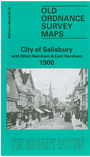
Sheet 66.15 covers the southern part of Salisbury, with coverage extending from Milford Street southward to East Harnham and Salisbury Workhouse, and from West Harnham eastward to Fowler's Hill. Features include Cathedral and The Close, St Nicholas Hospital, General Infirmary, Leyden Hall, Choristers School, Bishop's Palace, St Martin's church, clock factory, New Canal area, River Avon, Old Mill, West Harnham with St George's church, Parsonage Farm, East Harnham with All Saints church, Harnham House, Salisbury Union Workhouse, Harnham Bridge. On the reverse we include street directory entries for The Canal, Catherine Street, Exeter Street, The Friary, Milford Hill, Milford Street.
Each of the maps has a specially written introduction to the history of the area.