Old Ordnance Survey Maps of Wickford


We have published more than 1,800 maps in our series of Old Ordnance Survey Map reprints, some 30 of them in the Essex area. The maps are highly detailed. They are taken from the OS 1:2,500 (or 25 inch) maps and reduced to about 15 inches to the mile. They show streets with individual houses, tram tracks, railway tracks and even signals, factories, wharves and such details as fountains and water troughs. They will provide hours of fascination for historians and genealogists. The maps are neatly folded and each includes a specially written introduction to the area. Maps can be purchased on our On-line Mapshop where further information about titles is given. For other information and Prices, see Index Page.


Here are the details of maps for Wickford:

  • Essex (New Series) 72.16 Wickford 1919 - published 2005; introduction by Harry Carmichael

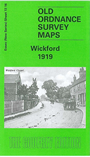
    This detailed map covers the town of Wickford, really little more than a village in 1919. The railway runs NW-SE across the map, with the station in the centre of the map. To the north streets are being laid out, with a scattering of houses among them. Coverage continues east to St Catherine's church and Wickford Hall. The introduction by Harry Carmichael tells the story of Wickford's growth, encouraged first by the railway and later the founding of Basildon New Town. A directory of Wickford in 1895 is included, together with a railway timetable for 1915.


    Follow this link for a complete list of our Essex & East Anglia maps or here for our London maps. A small scale Inch to the Mile map is also available giving a wider picture of the area.

    You can order maps direct from our On-line Mapshop. For other information and Prices, see Index Page.


    Maps in the Godfrey Edition are taken from the 25 inch to the mile map and reduced to about 15 inches to the mile. For a full list of maps for East Anglia, return to the East Anglia page.

    The Godfrey Edition / godfreyedition@btinternet.com / 8 October 2005