Old Ordnance Survey Maps of Warwickshire

  • These detailed maps normally cover an area of about one and a half miles by one mile. Each map includes an introduction.
  • They are available through our On-line Mapshop

  • Here are the details of maps for Rugby (South):

  • Warwickshire Sheet 28.07 Rugby (South) 1923 - published 1995; intro by Alan Godfrey. ISBN.978-0-85054-717-7

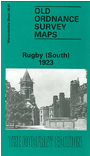
    This detailed map covers the southern part of Rugby, with coverage extending from Holy Trinity church southward to Rokeby House and Higher Rokeby. Features include Rugby School, LNER railway with station, Poor Law Institution (ie Workhouse), Technical School, Spring Hill House, Hospital of St Cross, St Marie's RC church, St Matthew's church, The Crescent etc. On the reverse we include a selection of street directory entries, including Caldecott Street, Clifton Road, Dunchurch Road, High Steet, Hillmorton Road, Pennington Street, Sheep Street, Union Street.

    The map links up with sheet 28.03 Rugby North to the north.


  • For a full list of maps of Warwickshire, please go to the Warwickshire or Birmingham pages.
  • You can order maps direct from our On-line Mapshop. For other information and prices, and other areas, go to The Index Page.
  • Maps in the Godfrey Edition are taken from the 25 inch to the mile map and reduced to about 15 inches to the mile.
  • For a full list of maps for England, return to the England page.
    Alan Godfrey Maps, Prospect Business Park, Leadgate, Consett, Co Durham, DH8 7PW / sales@alangodfreymaps.co.uk / 23 November 2017