Old Ordnance Survey Maps of Bedworth


We have published more than 2,200 maps in our series of Old Ordnance Survey Map reprints, and the series includes a very good group for the West Midlands. The maps are highly detailed. They are taken from the OS 1:2,500 (or 25 inch) maps and reduced to about 15 inches to the mile. They show streets with individual houses, tram tracks, railway tracks and even signals, factories, wharves and such details as fountains and water troughs. They will provide hours of fascination for historians and genealogists. The maps are neatly folded and each includes a specially written introduction to the area. Maps can be purchased on our On-line Mapshop. For other information and Prices, see Index Page.


Here are the details of maps for Bedworth:

  • Warwickshire Sheet 17.05 Bedworth 1923 - published 2004; introduction by Barrie Trinder

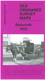
    This detailed map covers the large village of Bedworth, just north of Coventry. Most of the village is covered, with coverage stretching from John Street and Thomas Street eastward to the Coventry Canal and Weston Lawn Farm, and from the Coventry Road northward to Marston Lane. The features include Coalpit Field, LMSR railway with Bedworth station, Coventry Canal, Bulkington Road area, Hosiery Works, Bedworth sewage Works, Bedworth Charity Colliery with tramways to railway and canal, All Saints church, Hat Manufactory, Mount Pleasant area, Springfield Hall, Market Place, almshouses, tramway, Hawkesbury & Bedworth Brick and Tile Works, old shafts and coal workings, etc. On the reverse we include a directory of Bedworth in 1921.


    For a full list of maps of Warwickshire, please go to the Warwickshire page or Birmingham page.

    You can order maps direct from our On-line Mapshop. For other information and prices, and other areas, go to The Index Page.


    Maps in the Godfrey Edition are taken from the 25 inch to the mile map and reduced to about 15 inches to the mile. For a full list of maps for England, return to the England page.

    Alan Godfrey Maps, Prospect Business Park, Leadgate, Consett, Co Durham, DH8 7PW / godfreyedition@btinternet.com / 20 February 2009