 Here are the details of maps for Gateshead South:

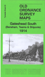
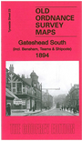
This detailed map covers the Bensham, Teams and Shipcote areas of Gateshead. Features on the map include Saltwell Park, Gateshead Union Workhouse, Bensham Brick Works, St Paul's Church, Bensham Hall, Christ Church, NER railway Line and Bensham Station, High Team Bridge, Nanny Rawley's Wood and Bensham Tower. We include extracts from early directories on the reverse.
The map links up with Tyneside Sheet 22 Dunston to the west, Sheet 18 Newcastle & Gateshead to the north, Sheet 24 Felling to the east, and Durham Sheet 06.08 Low Fell to the south.
Maps in the Godfrey Edition are taken from the 25 inch to the mile map and reduced to about 15 inches to the mile. For a full list of maps for the North East, return to the North East page.
The Godfrey Edition / sales@alangodfreymaps.co.uk / 27 October 2016