
 Here are the details of the map for Godalming:

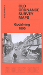
This detailed map covers the centre of Godalming, with coverage extending southward to Busbridge church. Features include railway with New Station, St Peter & St Paul church, Meath Home, Ockfordwood, Ockford Mill, Killcott, Hollowayhill House, Westbrook, mills, tannery, town centre with individual buildings shown, Rivey Wey, Godalming Bridge, Crownpits, Holloway Hill, Lammas Lands, Godalming Laundry, The Wharf, Salgasson Mill, Heath Farm etc. A list of private residents is included from a 1903 directory.
Busbridge church is notable for its links with Gertrude Jekyll and Edwin Lutyens. Westbrook is notable for its links with the Oglethorpe family, their Jacobite connections, and with James Oglethorpe, founder of the Colony of Georgia in America.