Old Ordnance Survey Maps of Surrey

  • These detailed maps normally cover an area of about one and a half miles by one mile. Each map includes an introduction.
  • They are available through our On-line Mapshop

  • Here are the details of maps for Guildford:

  • Surrey Sheet 23.16a Guildford 1895 - published 1999; intro by Alan Godfrey. ISBN.978-1-84151-136-8
  • Surrey Sheet 23.16b Guildford 1913 - published 2023; intro by Tony Painter. ISBN.978-1-78721-670-9

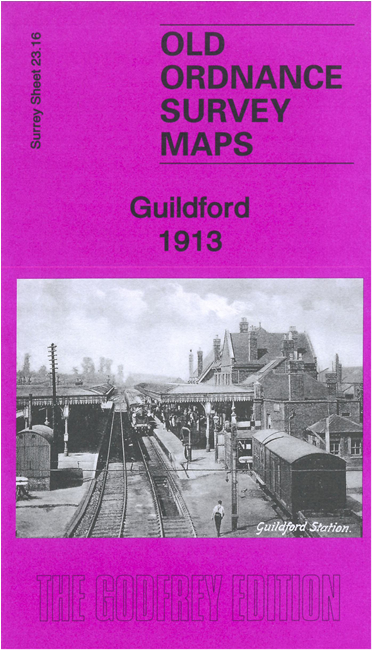
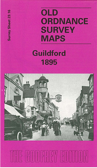
    We have published two versions of this map, showing how the area changed across the years.

    The maps cover the centre of Guildford. Coverage extends from Stag Hill eastward to London Road, and from Guildford Bridge and High Street northward to Wood Bridge, Woodbridge Park and St John's church.

    Features (from 1913 version) include town centre with individual buildings neatly shown, railways with station, junctions and engine shed, London Road station, cattle market, St Nicholas church, castle remains, St Mary's church, Royal Grammar School, Woodbridge Park, Woodbridge House, Stoke Park, Charlotteville, Royal Surrey County Hospital, Guildford Park Farm etc.


  • Follow this link for a complete list of our Surrey maps, here for Croydon, or here for the London Boroughs.
  • You can order maps direct from our On-line Mapshop. For other information and Prices, see Index Page.
  • Most maps in the Godfrey Edition are taken from the 25 inch to the mile map and reduced to about 15 inches to the mile.
    The Godfrey Edition / sales@alangodfreymaps.co.uk / 8 July 023