
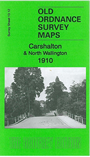
 Here are the details of the map for Carshalton:

This detailed map covers the centre of Carshalton, with coverage stretching northward to Hackbridge and eastward to north Wallington.
Features include railway with Carshalton and Hackbridge stations, All Saints church, Holy Trinity church Wallington, Three Arch Bridge, Wallington Bridge, Wallington Corner, Manor House, River Wandle, Hackbridge Mills, Water Mills, Carshalton House, tramway and depot, The Wrythe, St Andrew's church, watercress beds etc. On the reverse we include extracts from a 1903 directory of Carshalton.
The map links up with Surrey Sheet 13.08 Beddington Corner to the north, 13.11 Sutton North to the west, 14.09 Beddington to the east, 13.16 Carshalton South to the south.