Old Ordnance Survey Maps of Surrey

  • These detailed maps normally cover an area of about one and a half miles by one mile. Each map includes an introduction.
  • They are available through our On-line Mapshop

  • Here are the details of the map for Sutton (North):

  • Surrey Sheet 13.11 Sutton (North) 1910 - published 2012; intro by Richard Oliver. ISBN.978-1-84784-615-0

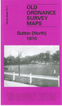
    This detailed map covers the north of Sutton, including Benhilton, with coverage from Clensham Lane to Manor Lane and eastward to Benhill Road.

    Features include St Barnabas church, Newtown area, tramway, Benfleet Hall, Benhilton area, The Green, All Saints church, Hallmead Farm, fireworks manufactory, Gandergreen Lane etc.

    The map links up with Surrey Sheet 13.12 Carshalton to the east, 13.15 Sutton to the south.


  • Follow this link for a complete list of our Sutton and Cheam or Croydon maps, or here for the London Boroughs.
  • You can order maps direct from our On-line Mapshop. For other information and Prices, see Index Page.
  • Most maps in the Godfrey Edition are taken from the 25 inch to the mile map and reduced to about 15 inches to the mile.
    The Godfrey Edition / sales@alangodfreymaps.co.uk / 21 February 2018