We have published more than 2,400 maps in our series of Old Ordnance Survey Map reprints, some 500 of them in the London area. The maps are highly detailed. They are taken from the OS 1:2,500 (or 25 inch) maps and reduced to about 15 inches to the mile. They show streets with individual houses, tram tracks, railway tracks and even signals, factories, wharves and such details as fountains and water troughs. They will provide hours of fascination for historians and genealogists. The maps are neatly folded and each includes a specially written introduction to the area. Maps can be purchased on our On-line Mapshop where further information about titles is given. For other information and Prices, see Index Page.
Here are the details of maps for Morden:
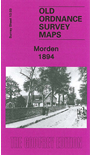
Morden is today perhaps best known for being the terminus of the Northern Line. Our map captures it when it was still a straggling village. Coverage stretches from Mordenhall Farm southward to Morden Park, and other features include Morden Hall, deer park, Morden House, Ravensbury Mills, Ravensbury Farm and a scattering of villas among the fields. On the reverse we include directories of Morden for 1903 and 1934.
The map links up with London sheet 142 Merton to the north.
Follow this link for a complete list of our Surrey maps or our London Series.
You can order maps direct from our On-line Mapshop.
For other information and Prices, see Index Page.
Maps in the Godfrey Edition are taken from the 25 inch to the mile map and reduced to about 15 inches to the mile.
For a full list of maps for London, return to the London page.