Old Ordnance Survey Maps of Merton

  • These detailed maps normally cover an area of about one and a half miles by one mile. Each map includes an introduction.
  • They are available through our On-line Mapshop

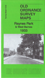
  • Here are the details of the map for Raynes Park:

  • Surrey Sheet 13.02 Raynes Park & West Barnes 1933 - published 2018; intro by Richard Oliver. ISBN.978-1-78721-136-0

    This detailed map covers the southern part of Raynes Park, south of the station, and also includes West Barnes and the eastern edge of New Malden.

    Features include Motspur Park station, Gramophone & Record Works, Bushey Works, Printing Works, Electrical Time Switch Works, Electric Accumulator Works, Seed Testing Station, The Blue House, Prince George's Playing Fields, Holy Cross Church, St Saviour's church, Grand Drive, Shannon Corner, Cannon Hill Common, Joseph Hood Recreation Ground.

    The map links up with Surrey sheet 13.01 New Malden to the west, 13.03 Morden to the east.


  • Follow this link for a complete list of our Kingston on Thames maps, or here for Surrey maps, or here for the other London Boroughs.
  • You can order maps direct from our On-line Mapshop. For other information and Prices, see Index Page.
  • Most maps in the Godfrey Edition are taken from the 25 inch to the mile map and reduced to about 15 inches to the mile.
    The Godfrey Edition / sales@alangodfreymaps.co.uk / 10 April 2018