Old Ordnance Survey Maps of Surrey

  • These detailed maps normally cover an area of about one and a half miles by one mile. Each map includes an introduction.
  • They are available through our On-line Mapshop

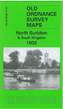
  • Here are the details of the map for north Surbiton:

  • Surrey Sheet 12.04 North Surbiton & South Kingston 1932 - published 2011; intro by Alan Godfrey. ISBN.978-1-84784-542-9

    This detailed map covers the area from Kingston Hall Road southward to St Mark's Hill, and from the Thames eastward to Vincent Road. Please note that the Middlesex shore is left blank.

    The map is split between Kingston and Surbiton. Features include St Raphael's RC church, Surrey County Hall, Technical Inst, Raven's Ait, St Mark's church, Seethinh Wells, St John's church, Kingston Cemetery, High School etc. On the reverse we include a list of Surbiton private residents from a 1934 directory.

    The map links up with Surrey sheet 12.03 Hampton Court to the west and 12.08 Surbiton to the south.


    Follow this link for a list of our maps for Surrey or here for a general list for the South East.

    You can order maps direct from our On-line Mapshop. For other information and prices, and other areas, go to The Index Page.


    Maps in the Godfrey Edition are taken from the 25 inch to the mile map and reduced to about 15 inches to the mile. For a full list of maps for England, return to the England page.

    Alan Godfrey Maps, Prospect Business Park, Leadgate, Consett, Co Durham, DH8 7PW / tel 01207-583388 / godfreyedition@btinternet.com / 16 January 2012