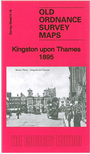
 Here are the details of the map for Kingston upon Thames:

This detailed map covers the centre of Kingston upon Thames in great detail with individual buildings neatly shown. Part of Hampton Wick is also shown. Coverage stretches from Normansfield and Wick Road (in Hampton Wick) eastward to Park Road and Manorgate Road (Kingston), and from St Albans Road southward to Washington Road.
Features include railway with Kingston and Hampton Wick stations, River Thames, town centre, All Saints church, brewery, Canbury Field, The Fairfield, Bunyon Chapel, Albany Club, Tiffins School, Norbiton Hall, St Peter's church Norbiton, Royal Cambridge Asylum, St Paul's church, Kingston Bridge, Normansfield, St John's church Hampton Wick, tannery, etc. Extracts from an 1897 street directory are included on the reverse, including entries for Caversham Road, Church Street, Eden Street, Fairfield Road, Fife Road, Market Place.
The map links up with Surrey sheet 6.12 Ham to the north, 7.13 Coombe to the east, 12.04 Surbiton North to the south. It also overlaps with Sheet 140 in our London series.